Quarantined At Home?
Enjoy these three full size, printable mazes while you’re stuck at home. Follow this link, right click and open the images in new tabs and then you can save them to your PC. https://imgur.com/a/4w8c2PJ . Don’t save the images from this blog, they’re compressed and I haven’t figured out how to fix it. The link has the full size printable versions.

Follow Link first, https://imgur.com/a/4w8c2PJ then right click on Image and Open In a New Tab and then you can download it to your PC to print. Lines can cross over/under each other for this maze.

Follow Link first, https://imgur.com/a/4w8c2PJ then right click on Image and Open In a New Tab and then you can download it to your PC to print. Lines can cross over/under each other for this maze.
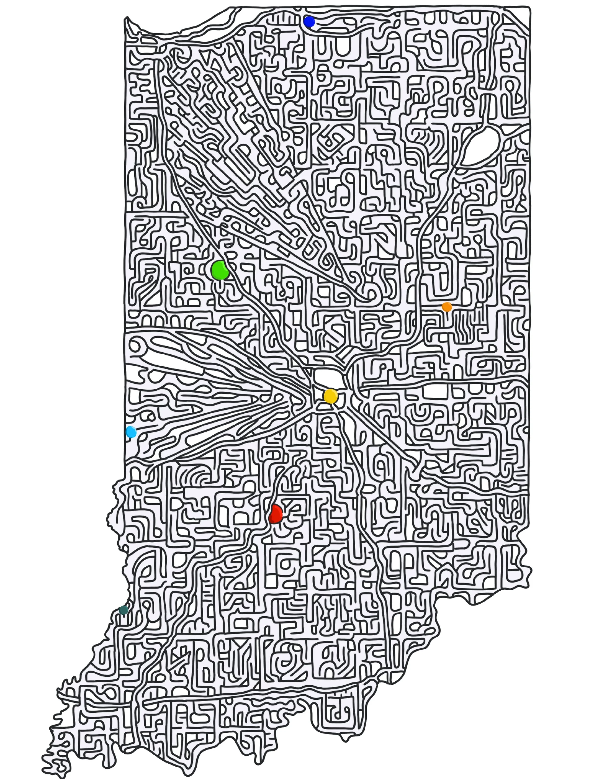
No ‘formal’ start or finish for Indiana. Instead, try to make it to each color dot! Represented is: Notre Dame (Purple), Purdue (Green), Ball State (Orange), Indianapolis schools - IUPUI, Butler, Marian, or your school of choice… (Yellow), Indiana State University (Light Blue), IU (red), and Vincennes University (Dark Teal). Sorry if I missed your school but the list of schools in Indiana is long and I’ve got to draw the line somewhere.
Follow Link first, https://imgur.com/a/4w8c2PJ then right click on Image and Open In a New Tab and then you can download it to your PC to print.
Washington State Maze
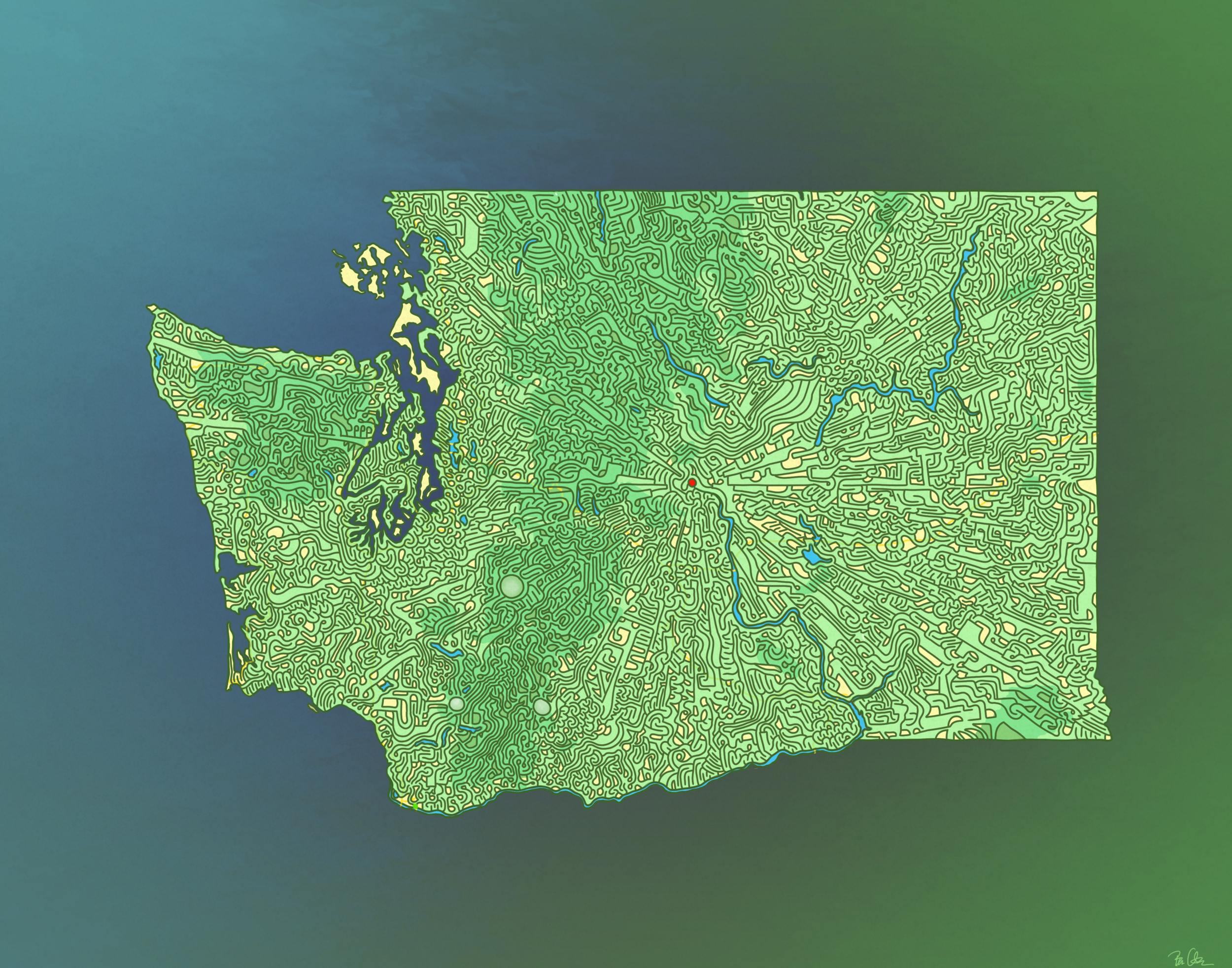
I skipped over about 13 states and went straight for the NW coast. This design lets the state and national forests/parks come through the background, and the major highways are highlighted with thin yellow lines.
This starts on I-5 (southwest corner, coming in from Oregon) and the end is the town of Wenatchee, smack dab in the center.
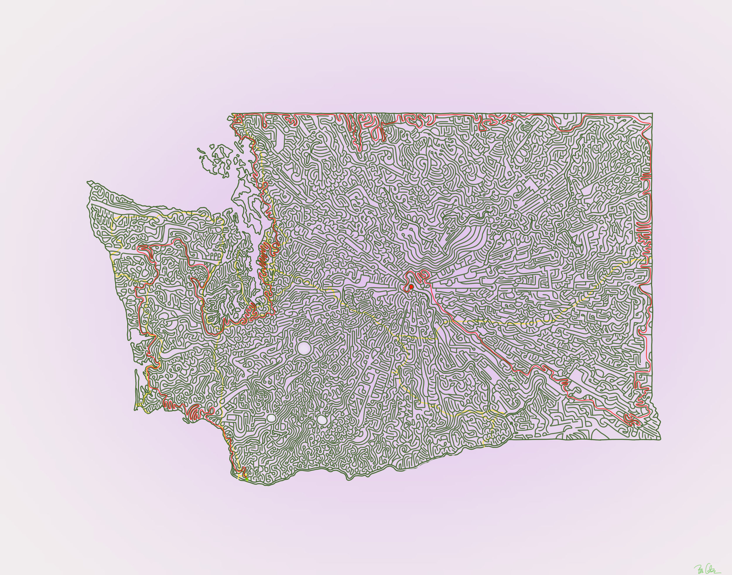
Just one possible route! This has several potential solutions
IU vs Purdue
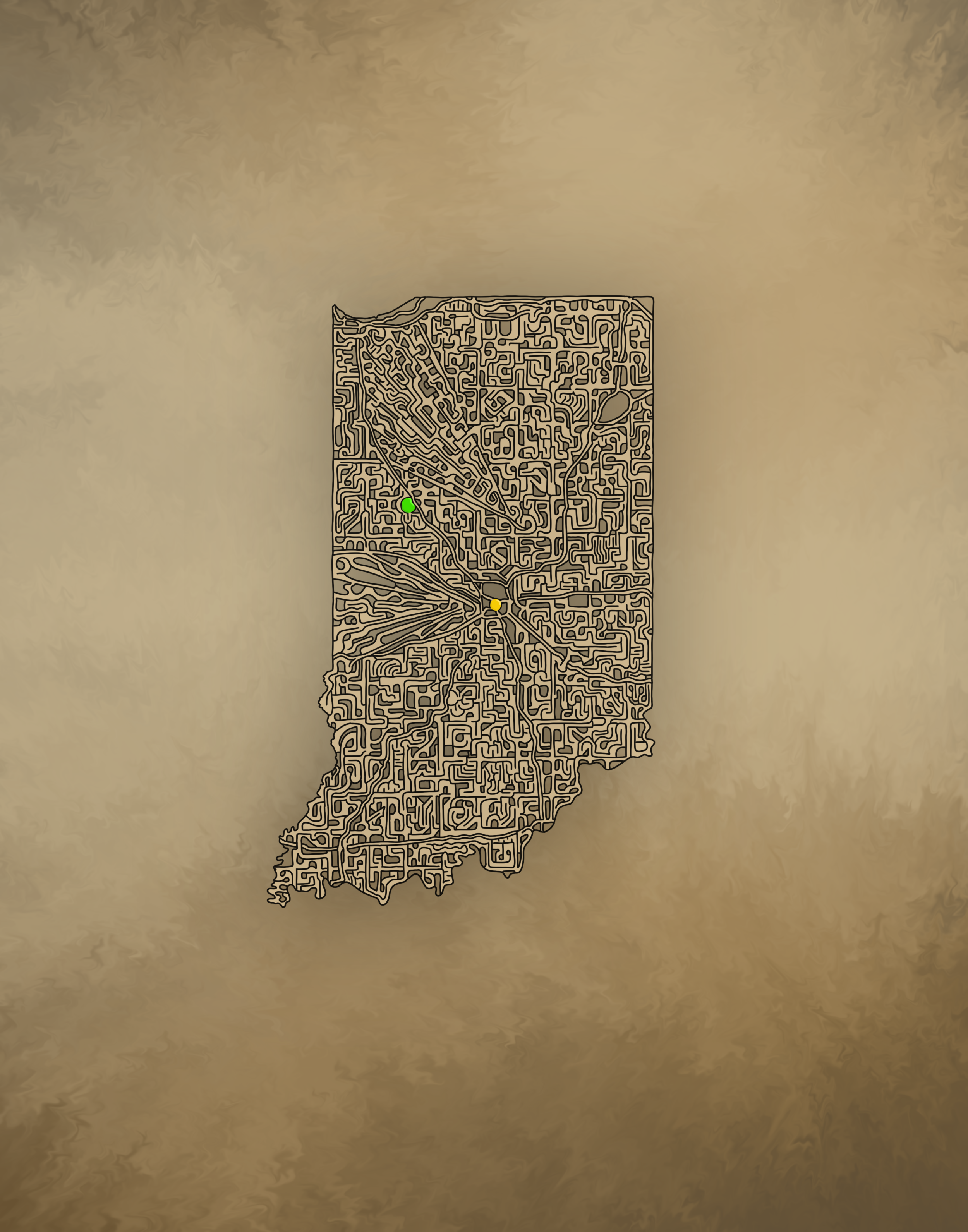
I couldn’t draw a maze of my home state without giving it a little extra attention! I ended up making two versions - one with a start in Bloomington (home of Indiana University) and one that starts in West Lafayette (Purdue University). Both of course are bathed in school colors. The finish is Indianapolis. Which do you prefer?
Black & Gold for Purdue
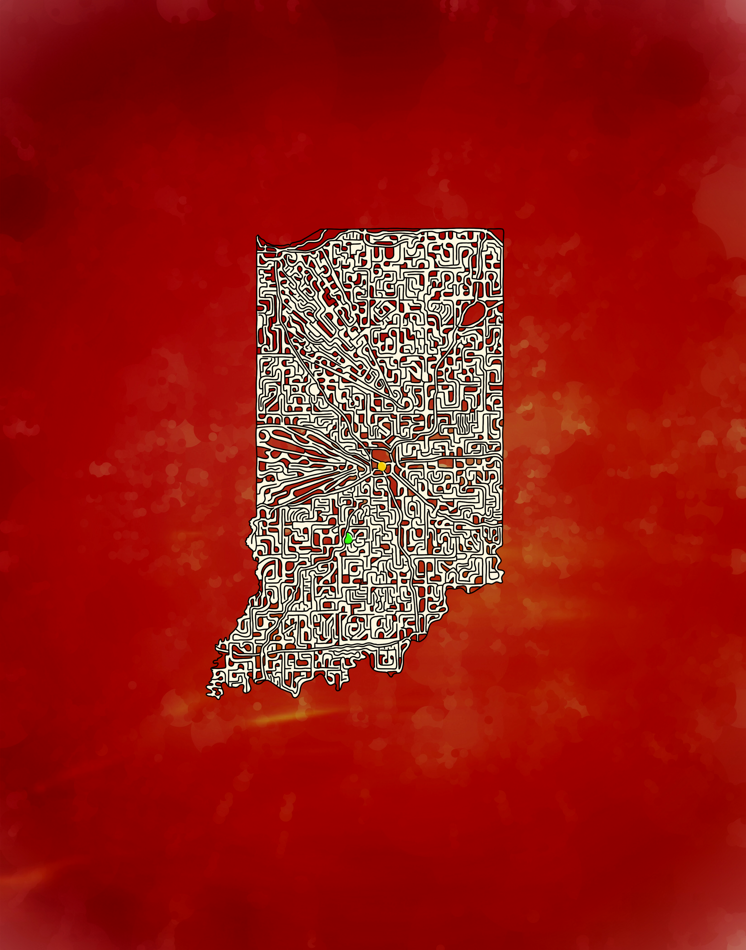
Cream & Crimson for IU
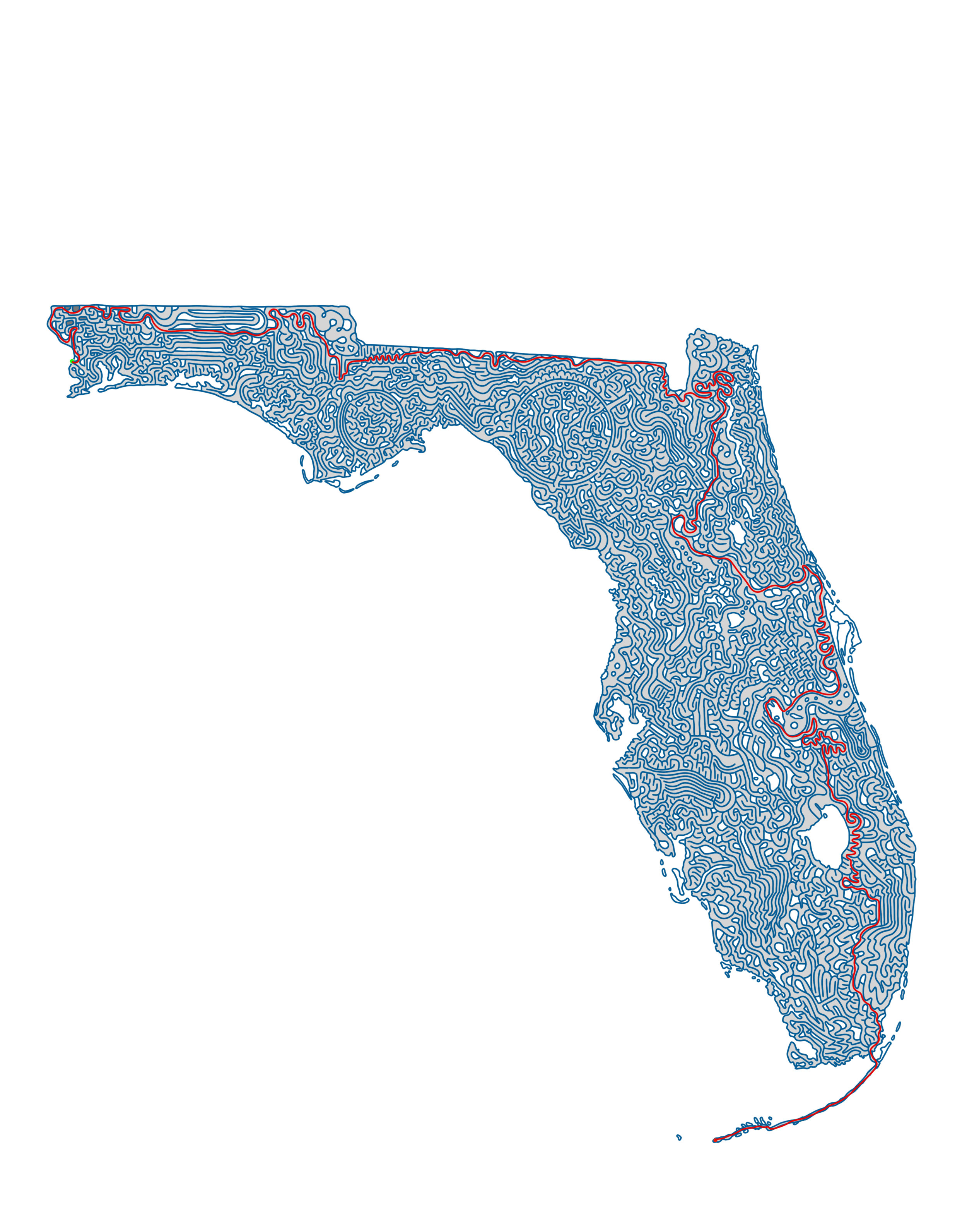
Florida + Solution
TIL Florida means “Land of Flowers” in Spanish. The goal here is to make your way from Pensacola all the way to Key West, and maybe swing by Disneyworld along the way too!
The blue pathways ended up being a little brighter than I expected - I’m sure I’ll tone it down for the coffee-table book :)

Ohio + Solution
I tried mixing up the overall maze design with Ohio, this time following more of a grid pattern instead of my usual whatever-I-feel-like/squiggly intestines. It might make things a little harder - the thing about drawing these from start to finish is every time you ‘branch’, it makes it easier to trace back from the finish. With the grid pattern, that trick might be harder to do. Let me know what you think!
The start for this is in Columbus - your goal is to make it all the way to Cedar Point in Sandusky for some R&R!


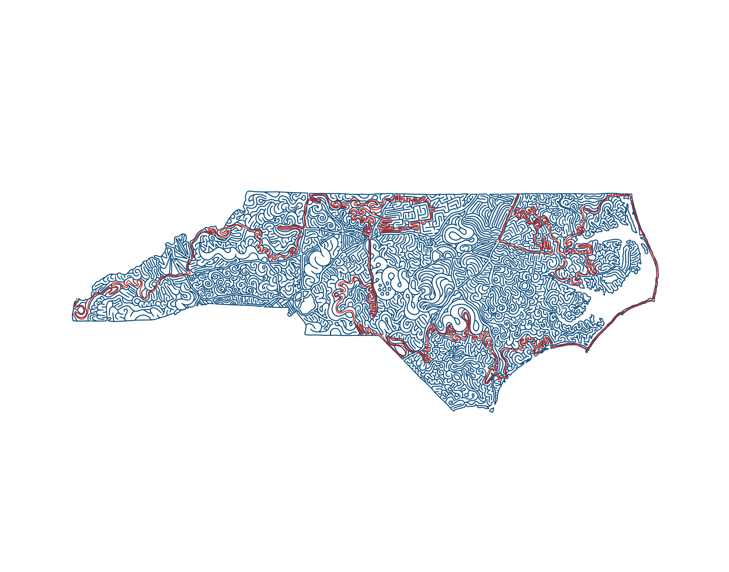
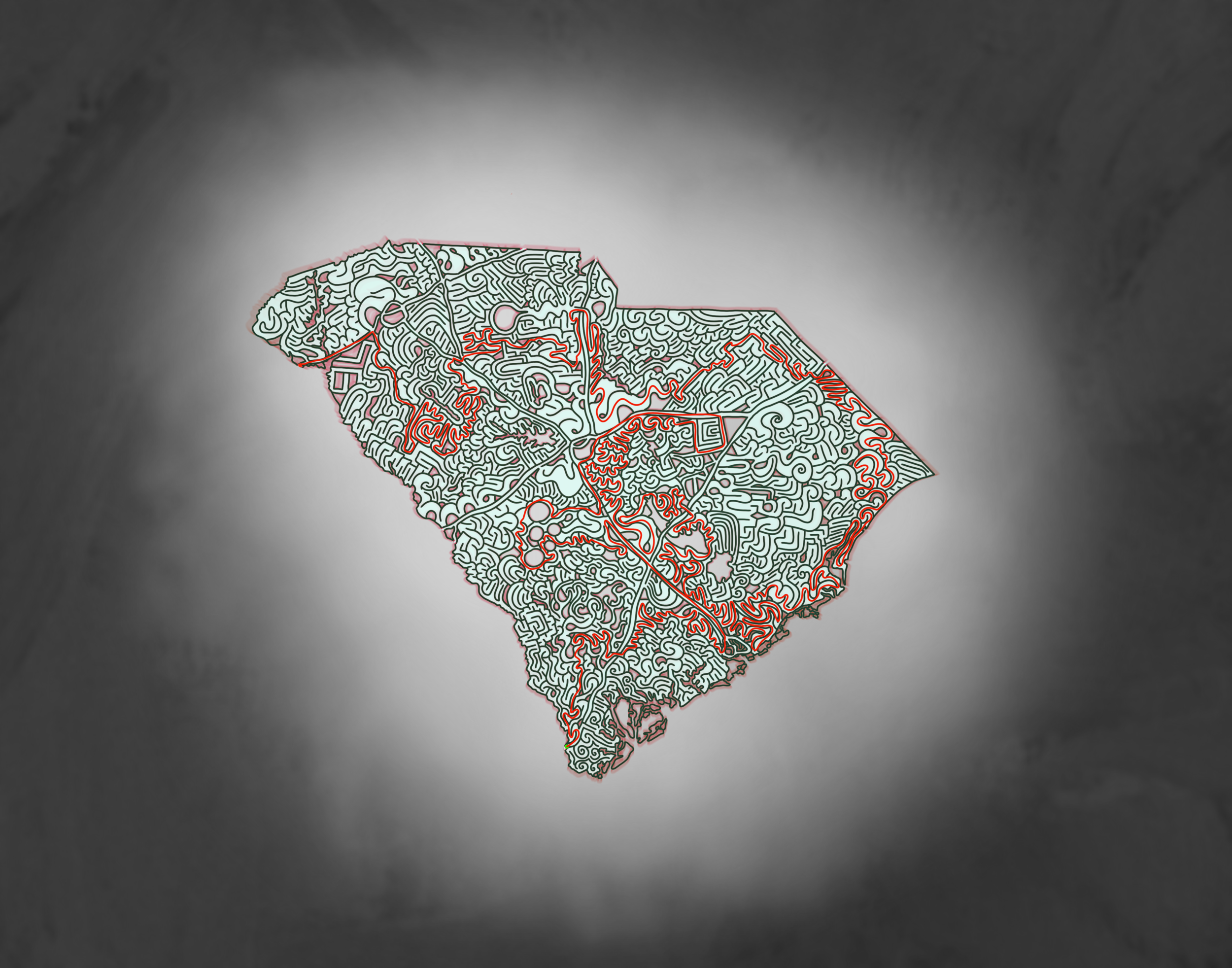
The Carolinas
Fun Fact: The Carolinas weren’t always North and South - they were once one big happy British colony until they split in 1712. These are the 15th and 16th State Mazes I’ve finished so far! It’s either Ohio or Georgia up next. I’ll flip a coin. I’d say North Carolina is a 5/7 on a difficulty scale, and South Carolina is just a bit easier.

I failed to indicate the start and finish here. The Start is I-95 coming from Virginia and the end is the far western tip. And yes, you get to trace aaaallll the way along the Outer Banks.

The Start for South Carolina is also I-95, this time coming up from the south (from Savannah Georgia). The finish is out I-85 out west, toward Atlanta. The color for this is unintentionally similar to West Virginia. I didn’t even notice until much later!
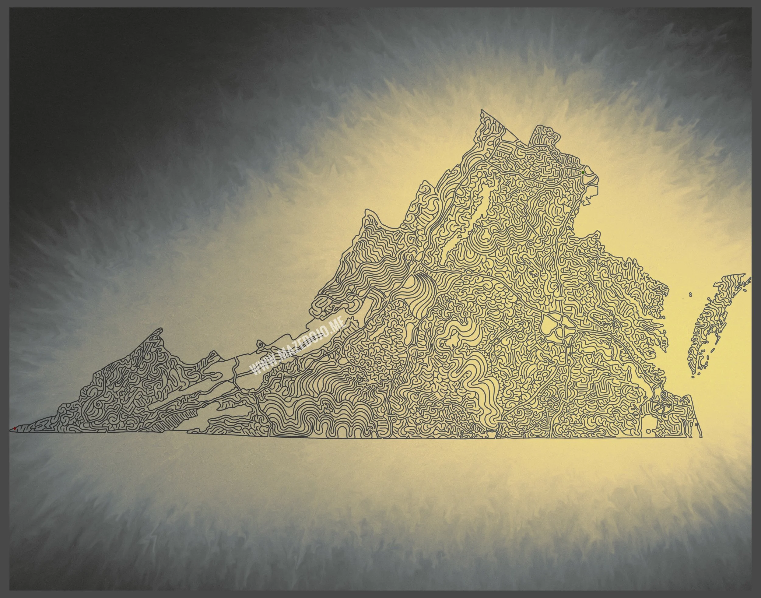
Virginia
These mazes are trending darker and darker… I love how this turned out though! The start for Virginia is up near Arlington/Washington D.C., and the exit is in the far western tip (Cumberland Gap National Historical Park). Fun fact: Virginia extends further west than West Virginia. As far as difficulty - I haven’t attempted it just yet but I’d say it’s middle-of-the-road. Plenty of wide paths and empty space made this a lot less complicated.
I opted to keep the Delmarva section outside of the maze - it looked a little goofy with a path connecting to it. So it’s just here for aesthetics and map integrity!
West Virginia Solution
West Virginia has several possible routes - this is just one possible solution. Most paths are not dead ends but instead loop back into other areas. I’m not sure if that makes things more frustrating or a little easier. Hopefully the latter!


Texas Maze
This maze is truly Texas-sized! This took about 6 days to complete, chipping away at it here and there in the evenings.
The intended start is down in the southern boot - I-69 in Brownsville, with the finish being El Paso in the west. Easier said than done - you’ll end up winding around between San Antonio and Dallas two or three times before you ever make it out to the western half. I tried making the western half a bit more ‘open’ too just as it is in real life, with wider paths and more space between them.
Good luck to anyone who tries to solve this! It won’t be easy… 5 out of 5 on a difficulty scale, I’d guess!

Yale University
I just finished drawing my Yale University maze this evening. I started with a campus map of all the various schools and colleges at Yale (parking lots, dormitories, etc are not included). I traced along some of the campus sidewalks and the cemetery roads (that’s the odd grid in the middle), but mostly I just meandered along, trying to connect all of the buildings together in one way or another.
This doesn’t have a proper start or finish. Instead, you can challenge yourself… can you get end-to-end? Or between two different sections? If you really want a challenge, try reaching every single building- yes it is possible!
